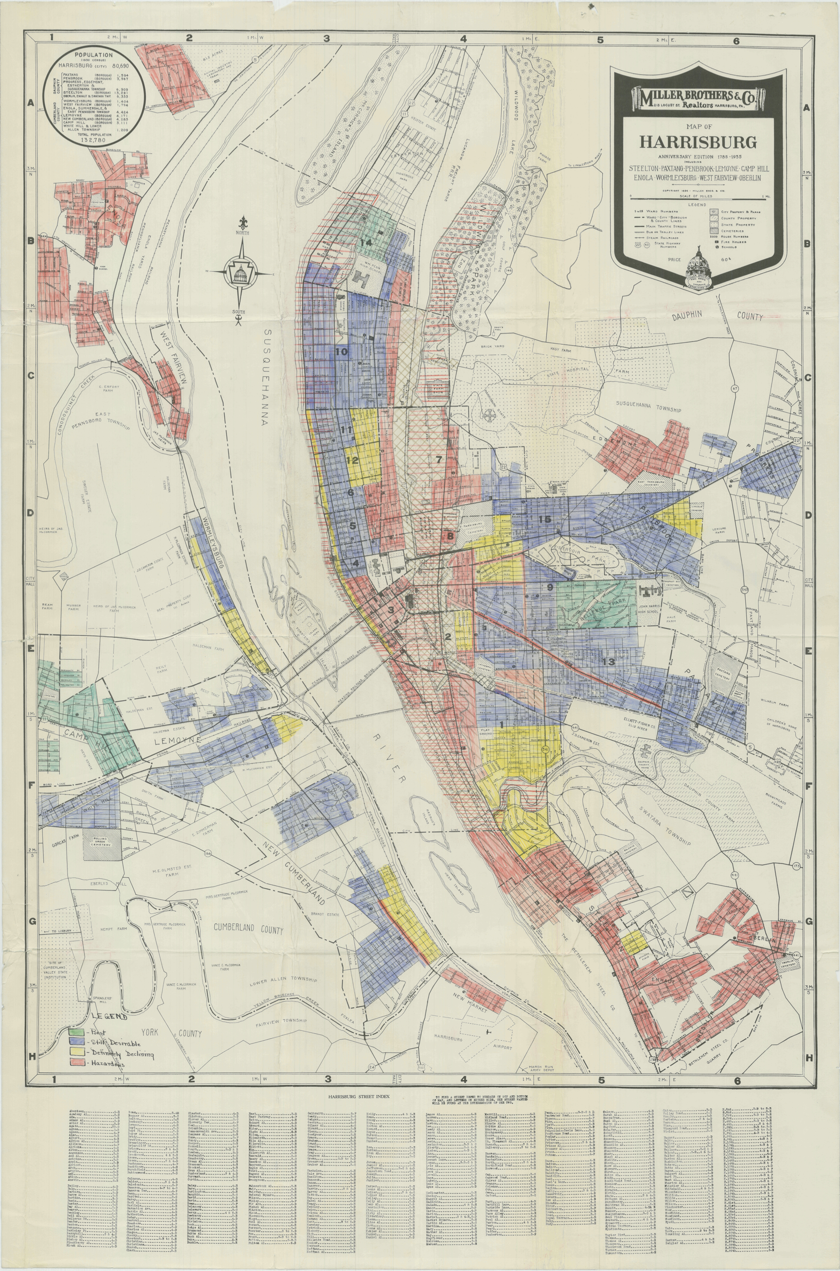
This zoning map of Harrisburg in 1935-1936 by the Home Owners' Loan Corporation shows the city and surrounding communities divided into four grades: “Best,” “Still Desirable,” “Definitely Declining,” and “Hazardous.” The insurance grades, which were designed to assess risk in awarding housing loans according to neighborhoods, was consequential in securing federal loans to the "best" districts, and none to "hazardous" areas.
An interactive version of this map is available at "The Redlining of Harrisburg" | Date: 1935-1936 | Source: National Archives, Record Group 195 of the Federal Home Loan Bank BoardDownload Original File
Source
National Archives, Record Group 195 of the Federal Home Loan Bank Board